Traver Ranch Area
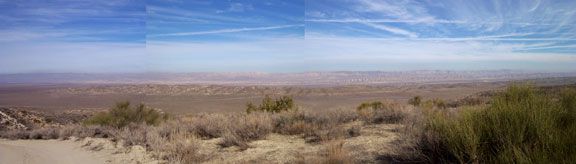
The composite at left is from the summit behind the old wood house, just before you start down the last .5 mile to the house.
|
|
|
Traver Ranch Area
|
||||||||||||||||
|
||||||||||||||||
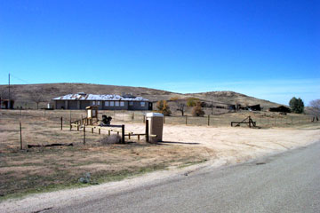
| After leaving the paved portion of Soda Lake Road at the South end of the Monument, travelling 6.7 more miles on dirt brings you to the Traver ranch (N 35° 04.124' W 119° 38.785'). There is a 1 mile paved section at this location that helped reduce dust when the Travers built the home in the early 1970's. The ranch house is fenced off and boarded up to protect an important bat refuge that exists inside the old home! There is a privvy here, and a kiosk with information. An interesting self-guided tour of antique farm equipment begins here. | ||||||||||||||||
| Note the fenceline above, bordering Soda Lake Road. Follow this fence back to the left, and where it comes to a corner ( N 35° 03.393' W 119° 36.299' ) you'll pick up the road that connects over to Padrone Canyon at the spring. | ||||||||||||||||
|
||||||||||||||||
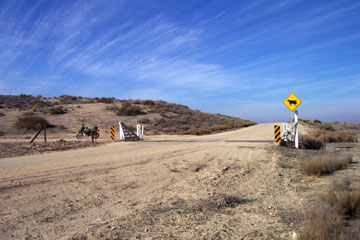
| <--3.5 miles North of the Traver ranch you will come to this cattle guard at N35° 04.534' W 119° 39.763' Unmarked Wells road takes off here to the West. This is a 10-mile in and out, with a loop at the top end that is interesting and provides some wonderful vistas and some great wildlife viewing. | ||||||||||||||||
|
||||||||||||||||
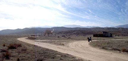
| After leaving Soda Lake Road, travel West. The road is mostly hard, but with some sandy corners. At 1.6 miles in there is a fork that goes to the South. Go right instead. That South fork is a dead end 1.2 miles up, but you can check it out on the way back. In the meantime, at 2.7 miles in you arrive at the fork shown here at the old Wells ranch. Note the steep hill in the background. You'll come down this on the way back. Take the right fork North past the old wood house from here. It actually doesn't matter, you'll end up back here anyway! ---> | ||||||||||||||||
|
||||||||||||||||
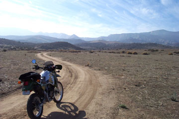
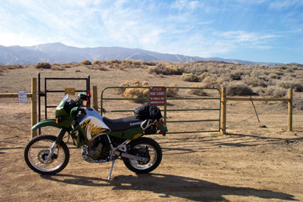
| 0.8 mile beyond the old wood house you'll pass by a house-trailer and outbuildings on the East side of the road. Just beyond is a wire gate.The photo at left is just passing through the gate (maybe 50m beyond). Not seen is a fork directly left of the bike after passing through the gate (and CLOSING it!). You can either take that fork right away, or proceed directly ahead 0.8 miles further up and dead end at the locked gate below. You'll want to take the South fork at the wire gate on the way back if you passed it by on the way in. | ||||||||||||||||
|
||||||||||||||||
| This gate is at N35° 03.746' W119° 42.972'. It's worth it to take a short hike up the trail and look back over the Plain. | ||||||||||||||||
|
||||||||||||||||
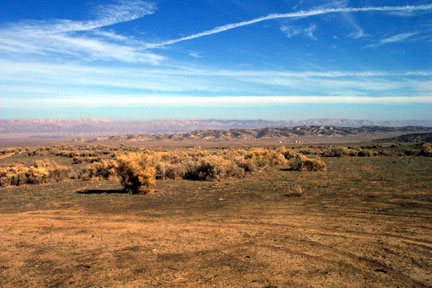
| The view looking East from the locked gate is breathtaking on a beautiful day like this one! (December. '02) | ||||||||||||||||
|
||||||||||||||||
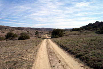
| Heading back the way you came in, take the South fork at the wire gate above the trailer complex. You go through a sandy arroyo and this pretty little draw (right). At N35° 03.025' W119° 41.794' you will find a short but steep incline to the East which brings you back down the steep hill behind the old wood house 2.3 miles from the wire gate. | ||||||||||||||||
|
||||||||||||||||
|
The composite at left is from the summit behind the old wood house, just before you start down the last .5 mile to the house. |
||||||||||||||||
|
||||||||||||||||