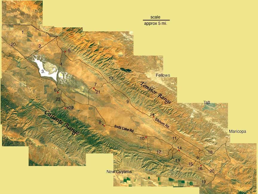
- 1. State Hwy 58
- 2. Seven Mile Road
- 3. Soda Lake
- 4. Simmler Road
- 5. Wallace Creek N35° 16.049' W 119° 49.625'
- 6. Goodwin Education Center N 35° 11.404' W 119° 51.796'
- 7. Panorama Road
- 8. KCL camp N35° 05.437' W 119° 44.093'
- 9. Elkhorn Road
- 10. Traver Ranch N 35° 03.484' W 119° 36.477'
- 11. "Cross-over" road
- 12. Padrone Canyon Road
- 13. Quail Springs Road
- 14. Hanline Ranch N 35° 00.131' W 119° 30.213'
- 15. Pipeline Road
- 16. South Entrance Kiosk/MU Ranch N 34° 59.412' W 119° 28.923'
- 17. Hurricane Road
- 18. Elkhorn Grade Road
- 19. State Hwy 166/33
- 20. Soda Lake Road N 34° 57.796' W 119° 26.774'
- 21. RC Place N35°11.339' W119°45.715'
- 22. Selby Camp N35° 07.699' W 119° 50.457'
- 23. Selby Road
- 24. Cochora Ranch N 35° 06.546 W 119° 36.425'
|
|