Panorama Road
N35° 05.548' W 119° 46.423'
|
|
|
Panorama Road
|
|
|||||||||||
| The Panorama Road (aka several other names) is a 6 mile stretch between a point on Soda Lake road 21 miles South of Hwy 58 and 24 Miles North of Hwy 166 and Elkhorn Road at a point 0.4 miles North of Hurricane Road. | ||||||||||||
|
||||||||||||
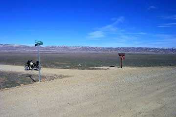
| The sign on Soda Lake Road is at
N35° 05.548' W 119° 46.423' |
||||||||||||
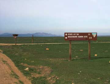
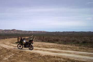
| Looking North from Soda Lake road you should see the BLM sign pointing to their Washburn Administration Site. Panorama takes off to the East from here. | ||||||||||||
|
||||||||||||
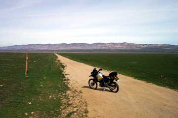
| From Soda Lake Road, Panorama appears to be straight and uneventful. While most of the road on the West side is that way, there are some interesting spots out in the middle and on the Eastern side. | ||||||||||||
|
||||||||||||
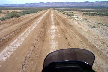
| About 1 mile in from Soda Lake Road, Panorama passes through the soggy middle of the Plain. This area gets really soft during rainy weather, and is nearly impassible, even for a dirt bike. You can see evidence here of the soda content and boggy nature of this region. After the rainy season is over, the road will be graded. | ||||||||||||
|
||||||||||||
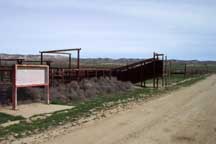
| 2.5 miles East of Soda Lake Road you encounter this gate. Panorama Road becomes San Diego Creek Road and bears off to the right. To the left, unseen in this photo is a fork that takes you for an uneventful ride straight back to Soda Lake Road. East of this gate (wire gate is usually open) the soil becomes sandier and firmer. | ||||||||||||
|
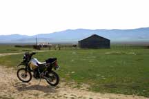
Approximately 1 mile East of the gate above you arrive at the old RC place (N35°11.339' W119°45.715'). There is a metal covered barn and a couple of other outbuildings. The left photo looks Southward. On the North side of the road are some old corrals and what remains of a scale. Several old grain tanks are on a small knoll behind these corrals. | |
||||||||||
|
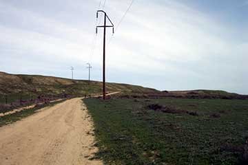
Another mile East from the RC place, the road takes you up and over the Panorama Hills. After you pass under the power lines and go through the cut at right center, there is a hillside that has been severely marred by 4-wheelers and bikers. Forget it. Pass on by and don't tear it up more than it already is. Incidentally, as you pass over the ridge here you are going right over the San Andreas fault! | |||||||||||
|
||||||||||||
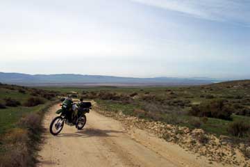
| This is a great view of the Plain from the Panorama Hills, just a short distance off Elkhorn Road. | ||||||||||||
|
||||||||||||
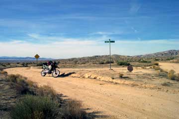
| This is the intersection of Panorama (called Soda Lake- San Diego Creek Road on the sign) on Elkhorn Road. It is located 0.4 miles North of Hurricane Road and 10.2 miles South of the Simmler Road intersection at N 35° 11.941' W 119° 43.286' .From this point you can travel approximately 13 miles North to 7 Mile Road or Hwy 58, or 25 miles South to the Elkhorn-Soda Lake Road intersection near the South end of the Monument. 7 Mile Road goes back across to Soda Lake Road. | ||||||||||||
|
||||||||||||