|
|
|
|
 |
|
|
|
| Soda Lake Road is the principle thoroughfare that transects the Carrizo Plain National Monument. Pashnit.com also has some info.
It is 45 miles long, 20 of which are unpaved. It connects State Highway 166/33 at the South to Hwy 58 at the North end of the Monument.
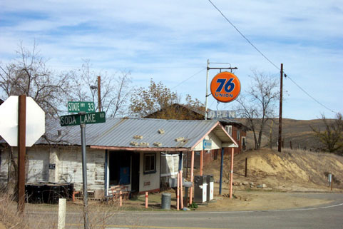
This is the Hwy 166/33 intersection, 15 miles East of New Cuyama.-->
|
|
 |
|
|
|
The South entrance to CPNM is marked by the now-defunct Reyes' Station 76 sign.
(N35°05.443' W119°37.809')
|
|
|
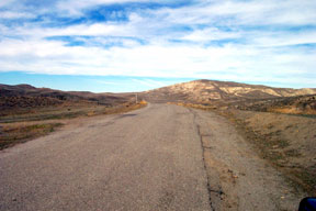
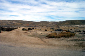
| This piece of road is typical of the southern paved portion of Soda Lake Road. It is paved, but patched and rough in some areas. Livestock on the road are common, as is the 'evidence' of such. |
|
|
|
|
 |
|
|
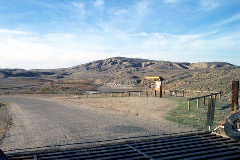
At N 34° 59.412' W 119° 28.923' , a point just 3 miles in from 166/33 you'll come to this kiosk. Aerial map # 16. Take time to stop, read the information, check maps and pick up a brochure. One of several sag ponds created by the nearby San Andreas fault is in the background. Look closely at the hill directly over the top of the kiosk. The dirt road you see on the ridge is Elkhorn Road. You pick it up just beyond the far end of the sag pond. (see below) |
|
|
|
 |
|
|
|
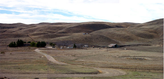
| Directly across from the Kiosk, to the Southwest, is the MU Ranch. |
|
|
|
|
|
|
|
 |
|
| 3.2 miles North of Hwy 166 at N 34° 59.630 W 119° 29.281' is the junction with Elkhorn Road. Aerial map # 9. The intersection is well marked with a sign on the West side of the roadway. The road is closed during rainy season. |
|
|
|
|
|
 |
|
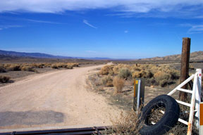
| After passing through the first narrow canyon, the pavement ends at this cattle guard 5.2 miles North of Hwy 166 at N 35° 00.639' W 119° 30.993', and just beyond Hanline Ranch. (Aerial map # 14 )The dirt here is hard packed and graded, but gets kind of nasty in the winter rainy months.
From the end of the pavement on the South end of Soda Lake, another 6.7 miles of dirt brings you to the Traver Ranch. (Aerial map # 10 )14.5 miles more of dirt brings you to the pavement at the North end of the Monument at N 35° 09.239' W 119° 48.539'
|
|
|
|
|
|
|
|
 |
|
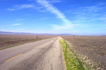
| When you hit pavement again after Traver Ranch, the road is paved from this point all the way to Hwy 58. The pavement on the North end is wider and in better condition than the South end. |
|
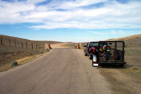
| BLM rangers patrol the area. If you are going to drive your p/u or trailer rig in, the rules say to park no farther off the road than is necessary to not block traffic. The photo below shows the idea. If you drive or park any farther off road, you are likely to get cited. Look for gravelly shoulders to use. |
|
|
|
|
|
|
|
|
|
|
 |
Main connectors off Soda Lake Road:
|
|
| Minor connectors
|
|
|
|
|
|
|
|
|
|
|
|
|
|
|
|
|
|
|
|
|
|
|
|
|
|
|
|
|
|
|
|