|
|
 |
|
|
|
|
|
|
|
|
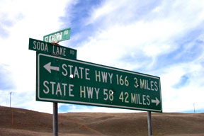
| Elkhorn Road is approximately 40 miles in length on the East side of Carrizo Plain, all dirt. At the Southern end, it can be picked up from Soda Lake Road at N 34° 59.630' W 119° 29.281' , a point 3 miles North of Hwy 166 (right). It is clearly marked by the sign below. It is also accessible from Elkhorn Grade Road which connects to Hwy 166 just north of Maricopa, Ca. and from 7 Mile Road near Hwy 58 |
|
|
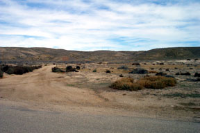
(above) At its South end, Elkhorn road goes up and over the ridge in the background. 100 feet in from Soda Lake road is a sign that will indicate whether this stretch is open or not. It will be closed during wet weather. |
|
|
|
 |
|
|
|
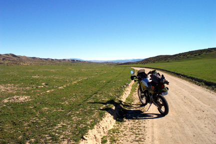
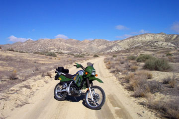
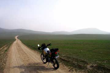
The two photos below show Elkhorn road in Fall (right) and Winter (left), after 2.75 inches of rain. The road segments shown are typical. There are a couple of boggy places along the way that make the road impassable during wet weather, but the road is graded periodically and is generally an easy ride offering grand views of the Plain to the West.
|
|
|
|
|
|
 |
|
 |
|
|
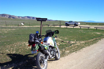
Wallace Creek (below) is located 1.2 miles South of the Simmler Road intersection, and 9 miles North of the Panorama Road intersection. There is a printable pdf self guided tour available from the Southern California Earthquake Center, and worth the butt-break to see this interesting geologic site. Wallace Creek straddles the Pacific and North American tectonic plates. As the Pacific plate has moved North, it has carried the West portion of the creek with it, offsetting it a couple of hundred feet! A short hike Eastward from the parking area N 35° 16.6049' W 119° 49.625' , takes you to the location.
|
|
 |
 |
|
|
|
|
|
|
|
 |
|
|
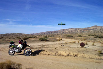
This intersection (right) is just beyond the Hurricane Road junction, N 35° 11.941' W 119° 43.286' .The sign is marked "Soda Lake San Diego Creek Road" but the outlet at Soda Lake Road 6 miles West indicates "Panorama Road". Go figure. From this junction its 10.2 miles North to Simmler road and roughly 13 to Hwy 58.
|
|
|
|
 |
|
| In the pic at left, you are still up on the mesa heading South from Hurricane Road. You can see some fog sneaking into the area in the distance. Over the ridge at center, you move down to Elkhorn Plain, where the terrain changes significantly. There is a crossover route to Soda Lake Road in that area. Try it. : ) |
|
 |
|
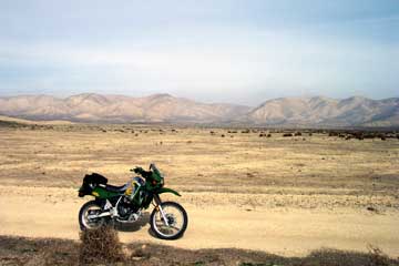
| The Elkhorn Plain area is quite barren down the center. This photo at the right shows some of the Temblor Range in the background. There are some really strange looking landscapes in this area. |
|
 |
|
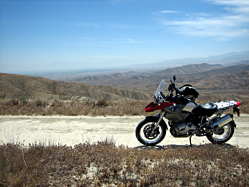
| Left photo is at the extreme southern end of Elkhorn Road. This area is known as Elkhorn Plain. 1/2 mile more and the road begins to wind up and over the ridge in the background, and dumps back onto Soda Lake Road. |
|
 |
|
|
|
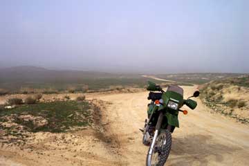
In the picture at right, I have just come up off the Elkhorn Plain from the area shown above. You are looking North. The fork is at N 35° 01.513' W 119° 28.927'. Going Southeast, the direction the bike is pointing, takes you down Elkhorn Grade to Hwy 166/33 just West of Maricopa. Going West, (to the left in the photo) takes you 3.3 miles back over to Soda Lake Road as in the photos at the top of this page. This photo was from February, '03 and obviously the fog was moving in.
|
|
|
|
 |
|
|
|
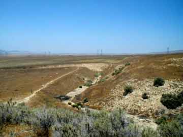
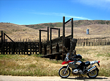
| Heading West takes you down a couple of small valleys and past this cool old set of stock pens. The road from here has some steeper grades and some ruts you have to pay attention to. The photo is May, '06. Most of the plain had turned brown, but there was still some greenery in this little hollow. |
|
|
|
 |
|
|
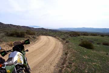
Taking the south fork described above runs you 5.6 miles down Elkhorn Grade Road where it intersects Hwy 166 2 miles West of Maricopa. N 35° 02.532' W 119° 25.227'. Elkhorn Grade has a couple of steeper parts, along with some ruts and loose rock and washboard. It does offer some nice views of the Central Valley, particularly if you ride it downhill toward Maricopa. |
|
|
|
|
Main Connectors off Elkhorn Road
|
|
|
|
|
| Other connections:
|
|
|
|
|
|
|
|
|
|
|
|
|
|
|
|
|
|
|
|
|
|
|
|
|
|
|
|
|