|
|
 |
|
|
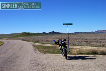
6 mile long Simmler Road connects Soda Lake and Elkhorn roads. You can pick it up at a N 35° 12.112' W 119° 51.448' , point 0.8 miles North of the Goodwin Education Center. The road sign indicates "Simmler Soda Lake San Diego Cr. Rd". Hmmm...take your pick I guess. |
|
|
|
|
 |
|
|
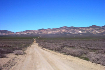
The first 200 feet of the road is paved, but becomes dirt after that. Believe the sign! The road passes over a dike that exists between two portions of Soda Lake. This section gets extremely boggy when wet. On the day I photographed this road (01/18/03) about 3 weeks had passed since the last rain, which had raised the area's total to about 2.75 inches for the season. The road was hard and firm at this time.
|
|
|
|
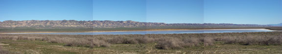
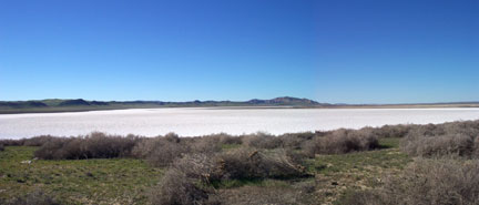
| The views of Soda Lake at right and below are from a point less than a mile in from Soda Lake Road.--> |
|
 |
|
|
|
 |
|
|
| The shots here were taken in mid-January. The panorama above is looking South, and the photo at left is looking north from the same spot. While there was water at this time in the Southern portion, only a couple of pools were visible in the Northern section. The area had experienced about 2.5 inches of rain for the season at this time. This is a Saltbush Scrub plant community. The white material is largely sodium sulfate. |
|
|
 |
|
| About halfway across the Plain, there is a stock water source with a large tank, barely visible in this shot. A barbed wire fence crosses the road at this point, and there is a wire gate that is sometimes closed. Expect it to be closed if you see cattle. Close the gate after passing through. |
|
 |
|
|
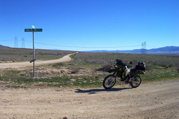
This is the connection of Simmler and Elkhorn roads. N 35° 17.008' W 119° 50.397' . Looking South here you can travel all the way over to Maricopa via the Elkhorn Grade, or end up back at Soda Lake Road 3 miles from Hwy. 166. Travelling just a short 3.0 mile ride to the North you'll reach 7 Mile Road near Hwy 58. 1.4 miles South is Wallace Creek. This is a spot of great geological interest where a short hike takes you to a location where the creek crosses the fault and has been offset several hundred feet.10.2 miles South from here, you'll come to the Panorama Road intersection. This is another 6 mile ride back to Soda Lake Road at a point near the BLM Admin site. |
|
|
Continuing South on Elkhorn Road 35 miles South from this intersection is the Soda Lake-Elkhorn intersection near the South end of the Monument. |
|
|
|
|
|
|
|
|
|
|
|
|
|
|
|
|
|
|